August 24, 2016 – The 2015 edition of the popular Quad Cities Area Street Map is still available through Bi-State Regio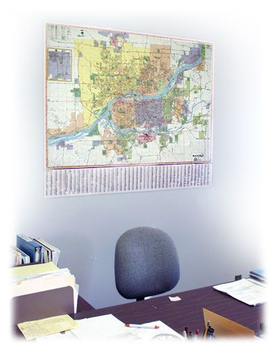 nal Commission. The map covers the metropolitan area and reflects changes to streets, corporate boundaries, landmarks, and other features that have occurred in the last four to five years. Two maps are available: a wall-sized (51” x 42”) full-color map on heavy paper; and a smaller (40” x 28”) color, folded version, which includes insets for the outlying communities of Aledo, Blue Grass, Clinton, Cordova, DeWitt, Eldridge, Geneseo, Kewanee, Muscatine, Port Byron, Princeton, and Walcott. Both maps are fully indexed for streets and places of interest.
Cost to the public for the wall maps is $25.00 each and the folded maps are $5.00 each. Member Governments may receive a free copy of each map. Both maps are available at the Bi-State Regional Commission office, and folded maps are available at the Quad Cities Convention and Visitors Bureau Visitors Centers, www.visitquadcities.com or the Quad Cities Chamber of Commerce, www.quadcitieschamber.com.
 June 22, 2016 – The adoption of the FY2017 budget brings to mind the question of what the first budget looked like in 1966. During the time period of December 1, 1966 to November 30, 1967, total expenditures were anticipated at $145,130 with $149,382 of income. Member dues were not broken out by community but administered by county, which included only Rock Island and Scott Counties. The largest expenditures went to personnel salaries at $71,700 and consulting fees at $29,830.
 The review is conducted every four years as a requirement of the Metropolitan Planning section of the federal transportation act and as an obligation for receiving federal funds. The review team included both Illinois and Iowa representatives from Federal Highway Administration (FHWA) and the state Departments of Transportation (DOTs) as well as FTA. A public hearing was held Tuesday, April 26, 2016 at the Quad Cities Transportation Policy Committee meeting to receive comments related to the effectiveness of multi-modal transportation planning activities by Bi-State Regional Commission.