Freight transportation plays a vital role in the Bi-State Region’s economy. As part of the supply chain, materials and products are moved from where they are produced to where they are consumed on the local and regional transportation network. Shipping may involve from one to a number of modes. There are four main types of shipping freight – road, rail, air and water. Goods movement delivers, transfers and moves commodities on this network of roads, rail, rivers and by air to other destinations. Goods movement is based on the demand for products produced in the Region or brought in from other areas. Shipping is sensitive to costs distance and time. As an important employment sector, freight transportation provides jobs and investment opportunities in the Region. In addition to the economic importance of freight movement, transportation planning looks at the kinds of products being moved including their origin and destination, condition of the modal network, safety, resilience to system disruptors, and impacts on people and the environment.
Bi-State Region Freight Plan
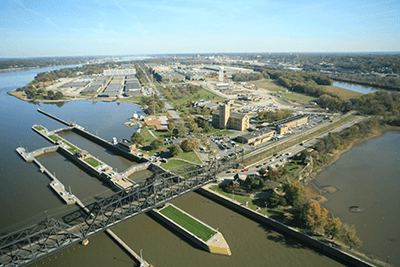
In 2015, Bi-State Regional Commission completed its first regional freight plan to inventory and examine freight conditions in the Bi-State Region. The geographic area included Muscatine and Scott Counties, Iowa, and Henry, Mercer and Rock Island Counties, Illinois. As a mutli-modal transportation plan, it highlighted strengths and weakness of the freight transportation system, including highway, rail, air and river goods movement. Key freight themes included the economy, infrastructure, operation, access/modal options and resiliency. The Bi-State Region is characterized as a production location based on industry clusters and logistics opportunities.
The Bi-State Region in eastern Iowa and western Illinois is situated on one of the largest river systems in the world, the Mississippi River also designated as a marine highway. Goods movement is connected to four main sectors:
- Agriculture, Forestry, Fishing and Hunting (Key Cluster- Agricultural Crops and farm animal processing)
- Manufacturing (Key cluster – Metal fabrication operations and food production)
- Mining, Quarrying and Oil and Gas Extraction
- Transportation and Warehousing (Key cluster – Transportation equipment production)
The largest commodities shipped to/from the Bi-State Region were cereal grains, gravel, non-metal mineral products and coal. Top three commodities by percent growth rate included pharmaceuticals, manufacturing products and transportation equipment.
In 2023, a data update was initiated to refresh the freight information and reach out to stakeholder on freight transportation issues and concerns. Updates on the plan will be included on this webpage as the plan evolves. A full plan update is anticipated in Spring 2024.
Upper Mississippi River Ports (UMRP)- Port Statistical Area (PSA)
The Upper Mississippi River Ports, under the name Mississippi River Ports of Eastern Iowa and Western Illinois, was designated a port statistical area by the National Waterborne Commerce Statistics Center (WCSC) in February 2020. The 15-county geographic area with 7 counties in Illinois and 8 counties in Iowa from approximately Dubuque Iowa to Keokuk, Iowa along the Mississippi River is home to over 150 existing facilities including 70 barge terminals. Along with other PSAs on the upper Mississippi and Illinois Rivers, it is part of the Corn Belt Ports. In 2020, UMRP moved over 8.4 million tons of commodities according to U.S. Army Corps of Engineers (USACE) data. The UMRP PSA provides a discrete linear statistical area to compare this segment of the Mississippi River’s good movement with other ports and PSAs in the United States. The 2020 tonnage ranked UMRP 11th among U.S. inland ports.
As part of a federally funded Statewide Planning and Research Grant, five regional planning agencies partnered to develop a webpage with verified port and terminal data to highlight the UMRP PSA. The UMRP webpage provides an asset inventory of the terminal/ports in the UMRP area, and identified partners and resources. The webpage also highlights a few terminals in UMRP PSA, and the economic impact these transportation facilities have in the region as well as nationally. Refer to the Ports/Terminals interactive map on this webpage.