- Details
- Written by: admin
- Category: Maps and Data
- Hits: 17049
Bi-State Regional Commission along with our member governments and the Illinois and Iowa Departments of Transportation have partnered with Waze to share road closures and other traffic alerts with the public. Browse the map above or download the Waze mobile application for iOS or Android to view live traffic information. Click “Expand Map” (top right) to open the map in a new tab.
- Details
- Written by: admin
- Category: Maps and Data
- Hits: 12380
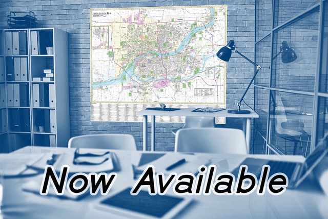
A new version of our popular wall map of the Quad Cities is now available. The 2021 edition is our first map that is designed and printed in-house and is the most accurate map of its kind. Locally researched in 2021 with hundreds of indexed points of interest, it covers the Quad Cities Metropolitan Area and is printed in full color on heavy matte stock.
- Details
- Written by: interGen support
- Category: Maps and Data
- Hits: 12620
The Quad Cities GIS Consortium is an open repository of local GIS datasets, maps, and web applications. Content is curated by Bi-State staff and local government partners.
- Details
- Written by: interGen support
- Category: Maps and Data
- Hits: 10555
Staff is involved with assisting member governments with various programs of the U.S. Census Bureau. The federal government allocates more than $675 billion in federal funds annually for health, welfare, infrastructure, education, and other federal programs and services. Maintaining correct information by working with the following programs helps ensure that the Census Bureau assigns the appropriate housing and population counts to each government so that governments receive funds appropriately and have the best data available for decision-making.
- Details
- Written by: interGen support
- Category: Maps and Data
- Hits: 10803
Our resource directory provides quick links to state and national datasets covering economic, demographic, and educational characteristics. It also includes GIS data on a variety of local and regional topics. Traffic counts, community Census data, and more can be found here.
- Details
- Category: Maps and Data
- Hits: 30890
Bi-State Regional Commission is the premier source for socioeconomic data on the Bi-State region (Henry, Mercer, and Rock Island Counties, Illinois, and Muscatine and Scott Counties, Iowa). Our staff compile a vast array of up-to-date information related to the five-county region and the states of Illinois and Iowa. We maintain a large store of information describing the socioeconomic characteristics of the Region (or any part within).
- Details
- Written by: admin
- Category: Maps and Data
- Hits: 26890
Our data services staff is available to assist with requests for data or research. Please contact our Data Services Staff. Data requests are prioritized by member governments, chambers of commerce and economic development organizations, academic institutions, federal or state government, businesses, and the general public. Requests from non-members are handled on a first come, first-served basis.