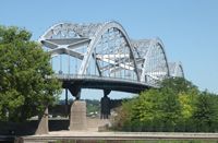
October 13, 2014 – Another delay has been announced for the Centennial Bridge. The bridge closure began August 3 and is expected to open by October 20, 2014. Prior and post closure, one lane restrictions off peak hour are possible. Due to the delay on the Centennial Bridge, the Corps of Engineers is reevaluating the schedule for work on Fort Armstrong Avenue. This project will affect cross river travel. Staff worked with CitiBus and River Bend Transit and Arsenal representatives on early notification of the Government Bridge swing span openings for transit routing. Radio and internet options were made available.
During the Centennial Bridge closure, area residents are encouraged to:
- Postpone meetings around the closure period or using teleconferences or webinars to reduce trips to meeting locations, or use internet 511ia.org to check traffic
- Hold meetings at the north and south ends of the Quad Cities, taking I-280 and I-80
- Give extra time to get to work, meetings and other events/activities
- Travel off peak hour times by avoiding 6:30 – 8:30 a.m. and 3:00 – 5:30 p.m.
- Allow more flexible schedules during the closure period for employees
- Check daycare/childcare options for extended hours if parents/family runs behind due to bridge travel
- Consider walking or bicycling. Park nearby and take the last leg of your trip by walking or bicycling via the Government Bridge or Centennial Bridge (anticipating access by pedestrians and bicyclists).
The Corps of Engineers offers a River Cam at Lock & Dam 15 that refreshes every 30 seconds. Travelers can check the status of the swing span as barges are locking through. There are electronic signs at the Davenport entrance to the Government Bridge and at IL92 at the Rock Island viaduct. When the sign reads "Swing/Draw Span Open" - it means that barges are locking through and vehicle traffic cannot travel across the bridge. This can take 20-30 minutes for those not familiar with this crossing.Go to River Cam (Locks and Dam 15): http://www2.mvr.usace.army.mil/MVRCams/RiverCam.cfm
Drivers can also use the IADOT website http://www.511ia.org/ and select the Quad Cities to monitor the river crossing traffic. There are other mobile apps, e.g. Google as well others to check traffic conditions.